

See Your NOTAMs on a Map: No More Coordinate Puzzles
11/11/2024
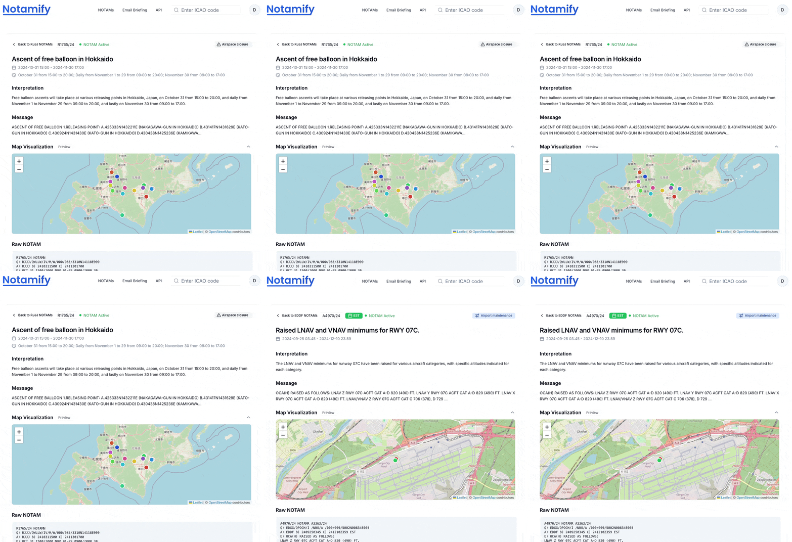
Ever tried to visualize a complex NOTAM area in your head? It's like trying to solve a geometry puzzle while planning a flight. That's why we built a map view that makes spatial NOTAMs easier to inspect.
From Coordinates to Clarity
Let me show you what I mean. Here's a recent NOTAM about drone operations in Akita, Japan:
UNMANNED ACFT:
1.FLT AREA: WI A RADIUS OF 1188M OF 401028N1404532E
            (KAZUNO-SHI IN AKITA)
2.WT      : 4KG
Instead of trying to plot these coordinates mentally, here's what you see in Notamify:
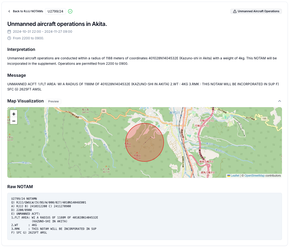
The circular restriction is visible on the map, showing you exactly where the drone operations are taking place. You can immediately see how it relates to nearby areas and assess its impact on your operations.
It Gets Even Better with Complex Areas
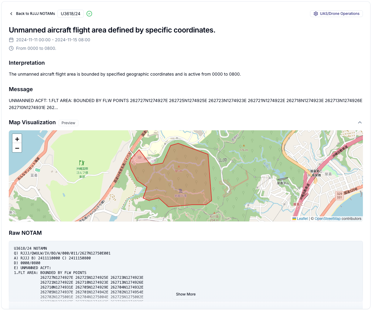
But that's just the beginning. Take a look at this NOTAM defining a complex flight area in Okinawa:
1.FLT AREA: BOUNDED BY FLW POINTS
            262727N1274927E 262725N1274925E 262723N1274923E
            262721N1274922E 262718N1274923E 262713N1274926E
            ...
Rather than trying to connect these dots in your head, the map gives you a clearer visual outline:
Multiple Points? No Problem
Here's where it gets really interesting. Look at this NOTAM about balloon operations in Hokkaido:
ASCENT OF FREE BALLOON
1.RELEASING POINT:
 A.425333N1432211E (NAKAGAWA-GUN IN HOKKAIDO)
 B.431417N1431629E (KATO-GUN IN HOKKAIDO)
 C.430924N1431430E (KATO-GUN IN HOKKAIDO)
...
Instead of a list of coordinates, you get this:
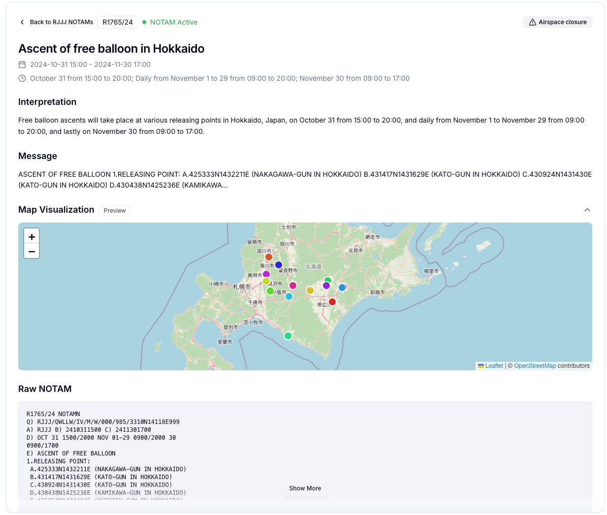
Each release point is clearly marked on the map, with tooltips that help identify what you are reviewing.
Obstacle Points? Here They Are
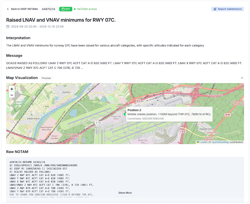
Notamify Map Visualization also shows obstacle points, which are often not visible in standard NOTAM charts. Important when you calculate performance for your flight. Here's an example from a NOTAM about a canes increasing the Obstacle Clearance Height in Frankfurt:
Why This Matters
I recently spoke with a pilot who spent 20 minutes plotting coordinates from a complex NOTAM, only to realize he'd made a small error that significantly changed the affected area. With a map view, users get a faster visual check before reviewing the official wording.
Try It Yourself
This map feature is part of Notamify Pro, and you can try it free for 7 days, cancel anytime. Explore the map feature and see how it can make your NOTAMs easier to understand.
Want to see it in action? Check out these live examples available for free preview:
- Drone operations in Akita
- Complex flight area in Okinawa
- Balloon operations in Hokkaido
- Obstacle points in Frankfurt
Have you tried our NOTAM maps? What would make them even more useful for you? Let us know through our feedback form or join our beta program - we build these tools for you, and your input directly shapes what we develop next.
P.S. Want clearer NOTAM summaries too? Check out our AI-powered briefings.

Read more...
Your AI Agent, Connected to Notamify
10/20/2026
Use Notamify coverage, interpretations and briefings in Codex, ChatGPT and Claude. Connect with your existing account and manage access in Notamify.
Track Starship NOTAMs and Restrictions
9/27/2026
Explore Starship launch restrictions, route closures and re-entry NOTAMs on one map, with notices grouped by airport and flight information region.
Faster Flight Briefings and Automatic Airport Summaries
9/25/2026
Flight briefings now generate 47% faster with improved accuracy. Airport summaries take around few seconds, with a new Auto option for airport pages.
4 Million NOTAMs: What Happens After an Airport Closes
9/12/2026
A review of airport closures, changing airspace restrictions and the information available to flight operations teams in Notamify’s archives.